Runit Dome
Monitoring Runit Dome
This webpage provides access of deliverables produced from a visual survey of the Cactus Crater Containment Structure on Runit Island at Enewetak Atoll. The visual survey was carried out using an Unmanned Aircraft System (UAS) carrying a DSLR camera to capture high resolution images and video of the structure.
The Operational Plan for the survey was developed and implemented by the U.S. Department of Energy (DOE) under the Marshall Islands Program. The survey was funded by DOE as an interim measure to allow for project continuation and fulfil periodic reporting requirements established under clause (B)(i)(I) of the Public Law P.L. 112–149, Insular Areas Act of 2011, to perform a visual study of the concrete exterior of the Cactus crater concrete containment structure on Runit Island.
Summary
A pre-survey inspection of the surface concrete failed to reveal any significant changes in the surface concrete compared with the photographic survey conducted in 2013. Over 1000 linear feet of crack and 34 spalls identified in the 2013 survey were subsequently repaired and a UAS survey flown to capture high resolution images and video of the structure at the closeup of the mission. It is anticipated that all remaining repairs to the surface concrete will be completed prior to the next scheduled visual UAS survey.
Products developed from the 2018 UAS survey included web accessible and viewable low and high resolutions images of the containment structure (identified as a 3D-Model and orthomosaic) along with associated video showing the more general nature of the structural integrity of the site.
It is expected that UAS surveys will help improve the ability of the program to produce more consistent visuals of the containment structure and, in association with current efforts to repair existing cracks and spalls, support efforts to investigate the rate of change of future deterioration in the condition of concrete panels (and in the overall integrity of the site).
EQUIPMENT AND METHODS
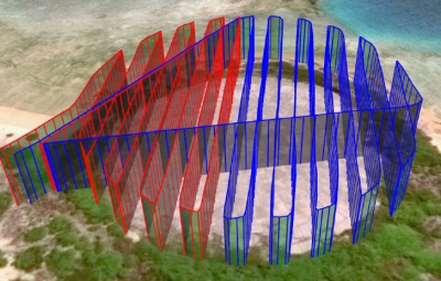
The need to develop an aerial platform for conducting visual surveys was driven by concerns about acquiring consistent visuals and providing adequate documentation of the condition of concrete panels. The 2013 survey was conducted over several days using a handheld camera at oblique angles to the surface of the concrete. The photographic record of concrete panels was variously affected by the dampness and puddling of the concrete, angle of the sun and other shadowing effects caused by cloud coverage. By using a UAS, the entire structure was surveyed in hours rather than days with the camera facing directly down.
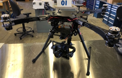
The current survey was conducted on a new survey UAS built on a VulcanUAS airframe like that shown in Fig 1. Images were compiled into an orthomosaic and 3D model animation using Pix4DMapper.
Refer to Hamilton and Nyholm (2021) for additional information on the survey methodology.
Selected Photo Record 2018 Visual Survey Report
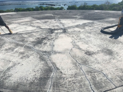
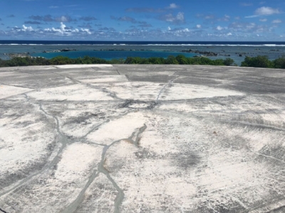
Viewers of this web site are referred to the orthomosaic to gain a full perspective of the condition of surface concrete covering the Cactus Crater Containment Structure. In general, no changes were observed in the condition of the concrete compared with that observed in 2013 except for those panels that were repaired.
Send a request to Terry Hamilton for access to view selected TIFF images of individual concrete panels and other miscellaneous photos from the 2018 survey (not copyright protected – use with acknowledgement).
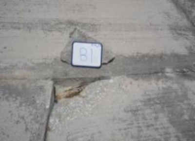
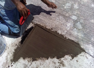
Panel B1 — Description
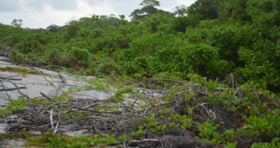
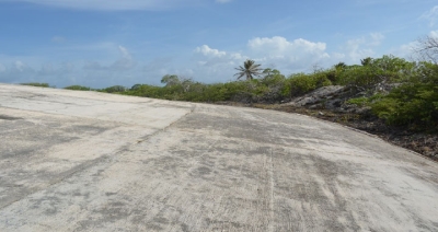
2013. Significant spalling of concrete observed in upper right corner where the chipped-out piece of concrete extends down to contaminated soil – cement grout waste pile mixture below. Surface crack observed running across the full width of the panel at a mid-point up the segment. Rooting vegetation removed from along the panel seams. Panel recommended for priority repair.
Top Cap Section
2018 SURVEY DELIVERABLES
- 3D Model Output. Downloadable low-resolution jpg image of the Cactus Crater Containment Structure on Runit Island.
The 3-D textured output file, from the link above, can be saved and viewed, and readily shared via email.
- Orthomosaic Output. Downloadable high-resolution viewable photo mosaic record of the Cactus Crater Containment Structure on Runit Island.
Send a request to hamilton18 [at] llnl.gov (Terry Hamilton) for access to download the image. Please note: viewing of this large file (app. 1.5 GB) can be cumbersome with use of most native image viewers. Start by downbloading the file to your computer. These non-commercial viewers are available to download for free on the internet:
- IrfanView (iview451_x64_setup.exe)
Viewing and zooming in on the Orthmosaic. Freeware for non-commercial use supporting Windows XP, Vista, 7, 8, and 10. The software is available in 32 and 64- bit. Refer https://www.irfanview.com/ for download instructions and usage agreement.
- QGIS (QGIS-OSGeo4W-3.20.0-4)
Recommended. QGIS is a professional GIS application licensed under the GNU General Public License. The current version is QGIS 3.20.0 'Odense' was released on 06/18/2021. Refer https://qgis.org/en/site/ for download instructions and access to the user guide, training manual, and QGIS tutorials. In the installer, choose Express Install and select QGIS to install the latest release or QGIS LTR to install the long-term release. The express installations have several optional packages including non-free software.
- IrfanView (iview451_x64_setup.exe)
- Runit Dome: Drone Flyover
Video production from the 2018 visual study of the concrete exterior of the Cactus crater concrete containment structure on Runit Island. This video production shows a drone-flyover visual of the Cactus Crater Containment Structure to help document larger-scale deterioration in concrete panels and possible changes that may be occurring in the overall integrity of the structure and/or in the condition of the riprap placed along the oceanside shoreline as a protective sea wall. [LLNL‑VIDEO‑765358]
- Runit Dome: Keywall
Video production from the 2018 visual study of the concrete exterior of the Cactus crater concrete containment structure on Runit Island. This video production provides a visual record of the condition of outside keywall extending around the N-E circumference of the dome and the riprap placed along the oceanside shoreline as a protective sea wall. [LLNL‑VIDEO‑765360]
- Technical Fact Sheet, The Runit Island Waste Containment Structure
Fact Sheet on the Cactus Crater Containment Structure (also known as Runit Dome). The fact sheet describes the status of knowledge pertaining to the possible impact of leakage of radioactive waste from the containment site into the environment. Draws on historical findings as well as contemporary studies conducted in support of Public Law P.L. 112–149. [LLNL‑BR‑755391]
- Runit Dome: 3D Animation
Video production from the 2018 aerial survey of the concrete exterior of the Cactus Crater Containment Structure on Runit Island. Separate to mandated requirements and funding received under Public Law P.L. 112–149, the video production draws attention to efforts of the U.S. DOE to include cosmetic repair of concrete panels in the study as proposed by LLNL scientists (Hamilton_LLNL-TR-648143). A decision to include cosmetic repair of concrete under the project was considered essential in terms of addressing widespread media and public perception that cracks in the concrete allow for potentially harmful quantities of fallout radioactivity becoming available for human exposure. An additional aim of including concrete repair in the study was to establish a modern-day baseline to help elucidate smaller scale changes and visual defects in the condition of the concrete over time. [LLNL‑VIDEO‑765357]
- Public Law 112–149 Continued Monitoring of Runit Island. STRATEGIC ACTIONS, KEY FINDINGS AND FUTURE WORK
Presentation briefing to the U.S. Department of Interior (DOI) on the status of studies conducted under Public Law P.L. 112–149, Insular Areas Act of 2011. [LLNL‑PRES‑771771]
- 2018 Visual Study Report on the Cactus Crater Containment Structure: Supplement to Web Page Reporting
Supplement to web-based reporting on the 2018 visual survey of the concrete exterior of the Cactus Crater Containment Structure on Runit Island. Includes a background description and details concerning the equipment and methods employed with selected photos of concrete panels. [LLNL‑TR‑824904]
- 2020 Report on the Status of the Runit Dome in the Marshall Islands
Prepared for Congress, the report includes a brief background regarding the Runit Dome (also known as the Cactus Crater containment structure) and addresses the Matters for Inclusion outlined in Section 364 of Public Law 116-92, National Defense Authorization Act for Fiscal Year 2020.


